In brief
At a glance
Quick Facts
- Impervious cover threshold for stream degradation
- As little as 10% impervious cover in a watershed can cause measurable ecological decline; severe impacts often occur above 30%.
- Runoff increase in urban areas
- Urbanization can increase surface runoff from a typical rainfall event by 2 to 5 times compared to a natural landscape.
- Groundwater recharge reduction
- In highly urbanized areas, groundwater recharge can be reduced by up to 90% relative to pre-development conditions.
- Urban heat island effect on precipitation
- Cities can be 1–3°C warmer than surrounding rural areas, potentially increasing downwind rainfall by 5–15% in some regions.
- Pollutant loads in urban runoff
- Urban stormwater runoff is a leading source of water pollution, carrying nutrients, heavy metals, and pathogens into water bodies.
- Green roof runoff retention
- Extensive green roofs can retain 50–80% of annual rainfall, reducing peak flows and cooling buildings.
- Combined sewer overflow frequency
- In cities with combined sewers, as little as 2.5 mm of rain can trigger overflows, discharging untreated sewage into waterways.
- Stream temperature increase
- Urban runoff can raise stream temperatures by 5–10°C, stressing cold-water fish species.
Key Takeaways
- Urbanization replaces natural, permeable land with impervious surfaces like roads and buildings, drastically reducing infiltration and increasing surface runoff.
- Increased runoff leads to higher flood peaks, reduced groundwater recharge, and greater pollutant loads entering waterways.
- Urban heat islands and reduced vegetation lower evapotranspiration, altering local humidity and precipitation patterns.
- Green infrastructure, such as rain gardens and permeable pavements, can restore natural hydrological functions and improve water quality.
What Is How Urbanization Changes the Water Cycle?
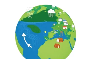
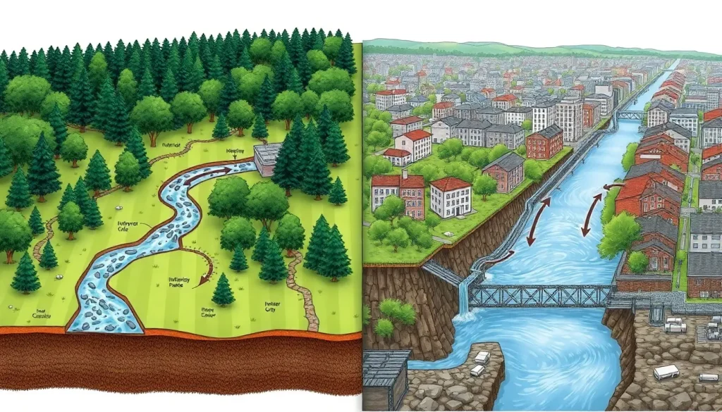
How urbanization changes the water cycle refers to the profound modifications that urban development imposes on the movement, distribution, and quality of water in the environment. In a natural landscape, precipitation is intercepted by vegetation, infiltrates into the soil, recharges groundwater, and is gradually released to streams and the atmosphere through evapotranspiration. Urbanization disrupts this balance by covering large areas with impervious surfaces—rooftops, roads, parking lots—that prevent water from soaking into the ground. Instead, water is rapidly channeled into storm drains, altering the timing, volume, and pathways of runoff.
This transformation is not merely a local issue; it has cascading effects on water resources, ecosystems, and human communities. The altered water cycle in cities leads to more frequent and intense flooding, reduced baseflow in streams, and increased pollution from urban runoff. Understanding these changes is critical for urban planners, engineers, and policymakers seeking to design resilient cities that manage water sustainably while protecting public health and the environment.
How It Works
The natural water cycle relies on a balance between precipitation, infiltration, evapotranspiration, and runoff. In undeveloped areas, as much as 50% of rainfall infiltrates the soil, 40% returns to the atmosphere through evapotranspiration, and only about 10% becomes surface runoff. Urbanization dramatically shifts these proportions. Impervious surfaces prevent infiltration, so a much larger fraction of rainfall—often 55% or more—becomes immediate surface runoff. This water is quickly funneled into storm drains and concrete channels, bypassing natural filtration and storage in soil and aquifers.
Additionally, the removal of vegetation reduces evapotranspiration, which normally cools the environment and returns moisture to the air. The result is a “flashier” hydrological regime: streams rise faster during storms, peak flows are higher, and the time between rainfall and runoff is shortened. Groundwater recharge declines, leading to lower water tables and reduced dry-weather streamflow. These changes also affect the thermal properties of urban water bodies, as runoff from hot pavements can raise stream temperatures, harming aquatic life.
Main Causes or Drivers
The primary driver of water cycle alteration in urban areas is the construction of impervious surfaces. Roads, sidewalks, parking lots, and rooftops seal the ground, preventing infiltration. The extent of impervious cover is a key indicator of hydrological impact; even low-density suburban development can significantly increase runoff. Another major cause is the installation of engineered drainage systems, such as storm sewers and channelized streams, which rapidly convey water away from urban areas, bypassing natural storage and slowing mechanisms.
Vegetation removal is a further critical factor. Clearing land for construction eliminates trees and plants that intercept rainfall, absorb water through roots, and release moisture into the air. Soil compaction during construction also reduces the infiltration capacity of remaining green spaces. Additionally, the urban heat island effect—where cities are warmer than surrounding rural areas—can alter local precipitation patterns, sometimes increasing rainfall intensity downwind of cities. Water supply and wastewater systems also play a role: importing water from distant sources and discharging treated wastewater into rivers changes the natural flow and quality of local water bodies.
Environmental and Human Impacts
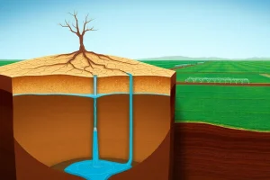
The altered urban water cycle has wide-ranging environmental consequences. Increased surface runoff leads to more frequent and severe flooding, overwhelming drainage systems and causing property damage. Stream channels often become incised and eroded due to higher peak flows, degrading aquatic habitats. Reduced infiltration lowers groundwater tables, which can deplete wells and reduce baseflow to streams, harming ecosystems during dry periods. Urban runoff also carries pollutants—oil, heavy metals, nutrients, pathogens—from streets and lawns into water bodies, causing eutrophication and health risks.
Human communities face direct and indirect impacts. Flooding damages infrastructure, disrupts transportation, and poses safety hazards. Water scarcity can arise from diminished groundwater recharge, especially in cities reliant on local aquifers. Degraded water quality increases treatment costs for drinking water and limits recreational use of rivers and lakes. The urban heat island effect, exacerbated by reduced evapotranspiration, raises energy demand for cooling and contributes to heat-related illnesses. These impacts disproportionately affect vulnerable populations, including low-income neighborhoods with less green space and older infrastructure.
Regional Differences
The effects of urbanization on the water cycle vary by climate, geography, and development patterns. In humid regions, increased runoff is the dominant change, leading to more frequent flooding and erosion. In arid and semi-arid cities, reduced infiltration can critically deplete already scarce groundwater resources, while imported water and irrigation may artificially raise water tables, causing waterlogging and salinization. Coastal cities face compounded challenges: urbanization increases runoff and pollutant loads to estuaries, while sea-level rise and land subsidence heighten flood risks.
Development density also matters. Compact cities with high-rise buildings may have less per-capita impervious cover than sprawling suburbs, but they still generate concentrated runoff and heat islands. In rapidly urbanizing regions of Asia, Africa, and Latin America, informal settlements often lack adequate drainage and sanitation, making residents highly vulnerable to flooding and waterborne diseases. In contrast, older cities in Europe and North America may struggle with combined sewer overflows, where stormwater and sewage mix during heavy rains, releasing untreated waste into rivers.
Solutions
Mitigating the hydrological impacts of urbanization requires a combination of green infrastructure, policy reforms, and technological innovations. Green infrastructure mimics natural processes by using vegetation, soils, and permeable materials to manage stormwater at its source. Examples include rain gardens, green roofs, permeable pavements, and constructed wetlands. These features promote infiltration, reduce runoff, filter pollutants, and enhance evapotranspiration, helping to restore pre-development water balance.
At the policy level, low-impact development (LID) standards and stormwater management regulations can require new developments to retain or treat a certain volume of runoff on-site. Retrofitting existing urban areas with rain barrels, bioswales, and tree planting programs also helps. Water-sensitive urban design integrates water cycle management into city planning, considering the entire watershed. Additionally, preserving natural drainage corridors, floodplains, and riparian buffers is essential. Public education and incentives for property owners to adopt green infrastructure can further amplify these efforts.
What the Evidence Shows
Numerous studies have quantified the hydrological changes caused by urbanization. Research consistently shows that as the percentage of impervious cover in a watershed increases, stream flashiness, flood frequency, and pollutant loads rise, while baseflow and water quality decline. Long-term monitoring in urbanizing basins reveals that even 10% impervious cover can cause measurable ecological degradation, and impacts become severe above 30% imperviousness. Comparative studies between urban and rural catchments demonstrate that peak discharges can be several times higher in urban areas for the same rainfall event.
Evidence also supports the effectiveness of green infrastructure. Field studies show that rain gardens can capture 90% or more of runoff from small storms, and permeable pavements can reduce runoff volumes by 50–90% compared to conventional asphalt. Modeling studies indicate that widespread adoption of LID practices can significantly reduce combined sewer overflows and improve groundwater recharge. However, the performance of these solutions depends on local soil conditions, climate, and maintenance, and their cumulative effect at the watershed scale is an area of ongoing research.
FAQ
What is the main way urbanization changes the water cycle?
Urbanization primarily changes the water cycle by covering land with impervious surfaces, which prevents water from soaking into the ground. This increases surface runoff, reduces groundwater recharge, and decreases evapotranspiration, leading to more flooding and less natural water storage.
How does urbanization affect water quality?
Urban runoff picks up pollutants such as oil, heavy metals, fertilizers, and bacteria from streets and lawns, carrying them into rivers, lakes, and coastal waters. This can cause algal blooms, harm aquatic life, and contaminate drinking water sources.
Why does urbanization matter for water resources?
It matters because over half the world’s population lives in cities, and urban water cycle changes threaten water supply, increase flood risks, and degrade ecosystems. Managing these impacts is essential for public health, economic stability, and environmental sustainability.
References
- U.S. Environmental Protection Agency (EPA). “Urbanization and Streams: Studies of Hydrologic Impacts.” EPA 841-R-97-009.
- Leopold, L. B. (1968). “Hydrology for Urban Land Planning—A Guidebook on the Hydrologic Effects of Urban Land Use.” U.S. Geological Survey Circular 554.
- National Research Council. (2009). “Urban Stormwater Management in the United States.” The National Academies Press.
- Shuster, W. D., et al. (2005). “Impacts of impervious surface on watershed hydrology: A review.” Urban Water Journal, 2(4), 263-275.