In brief
At a glance
Quick Facts
- Definition
- A long, narrow corridor of concentrated water vapor transport in the atmosphere.
- Typical length
- Thousands of kilometers, but only 400–600 km wide on average.
- Water vapor transport
- Can exceed 7.5–15 times the average flow of the Mississippi River.
- Global occurrence
- Found over all major ocean basins, most common in mid-latitudes.
- Precipitation contribution
- Provide 30–50% of annual precipitation on the U.S. West Coast.
- AR Scale categories
- Ranges from Category 1 (weak, beneficial) to Category 5 (exceptional, hazardous).
- Key metric
- Integrated water vapor transport (IVT), measured in kg/m/s.
- Climate influence
- Modulated by ENSO, MJO, and other large-scale patterns.
Key Takeaways
- Atmospheric rivers are long, narrow plumes of concentrated moisture in the atmosphere that transport water vapor from the tropics to mid-latitudes, often carrying more water than the Amazon River.
- They are a primary mechanism for poleward water vapor transport and can produce extreme precipitation when forced upward by mountains or weather systems.
- While they are essential for replenishing water supplies and snowpack, they also cause major flooding and landslides, especially when they stall or arrive in rapid succession.
- Their frequency and intensity are influenced by large-scale climate patterns such as El Niño–Southern Oscillation (ENSO), and a warming climate is expected to make them more intense due to increased atmospheric moisture capacity.
What Are Atmospheric Rivers?
An atmospheric river (AR) is a long, narrow, and transient corridor of strong horizontal water vapor transport in the lower troposphere. These features are typically associated with a low-level jet stream ahead of the cold front of an extratropical cyclone. They are often described as “rivers in the sky” because they can transport water vapor at rates comparable to the largest terrestrial rivers. For example, a strong atmospheric river can move water vapor equivalent to 7.5–15 times the average flow of the Mississippi River at its mouth.
Atmospheric rivers are a fundamental component of the Earth’s water cycle, linking evaporation in the warm tropical and subtropical oceans to precipitation in the mid-latitudes. They are most common in the winter half of the year in each hemisphere, when the temperature contrast between the equator and poles drives strong storm tracks. Although they cover less than 10% of the Earth’s circumference at any given latitude, they account for over 90% of the poleward water vapor transport in the mid-latitudes. Their presence is often identified by integrated water vapor transport (IVT) values exceeding a threshold, typically 250 kg per meter per second, and they can stretch for thousands of kilometers while being only a few hundred kilometers wide.
Overview
Atmospheric rivers are a well-established meteorological phenomenon, though the term itself gained widespread scientific and public recognition in the late 20th and early 21st centuries. They are most frequently observed over the North Pacific and North Atlantic oceans, but they occur globally, including over the South Pacific, South Atlantic, and Indian oceans. The “Pineapple Express” is a well-known example of an atmospheric river that transports moisture from the tropical Pacific near Hawaii to the West Coast of North America.
These features are not uniform; they vary in strength, duration, and orientation. To help communicate their potential impacts, researchers developed the AR Scale (introduced by Ralph et al. in 2019), which categorizes atmospheric rivers from Category 1 (weak, primarily beneficial) to Category 5 (exceptional, primarily hazardous). The scale considers both the maximum IVT and the duration of the event. Most atmospheric rivers are weak to moderate and provide beneficial rain and snow, but the strongest events can lead to catastrophic flooding.
How It Works
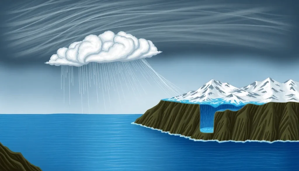
Atmospheric rivers form when a strong low-level jet stream draws moisture from a warm ocean region into a narrow band ahead of a cold front. The moisture is concentrated in the lower 1–3 kilometers of the atmosphere. As the air moves poleward, it cools, and the water vapor condenses into clouds and precipitation. The key lifting mechanisms are orographic lift (when the moist air is forced up over coastal mountains) and frontal lift (when warm air rises over colder air). This forced ascent cools the air to its dew point, releasing the moisture as rain or snow.
The intensity of precipitation depends on the amount of water vapor, the strength of the winds, and the duration of the event. When an atmospheric river stalls over a region due to a blocking high-pressure system, it can produce prolonged heavy rainfall, leading to flooding. Conversely, a fast-moving AR may bring only moderate precipitation. The integrated water vapor transport (IVT) is the standard metric used to identify and classify atmospheric rivers, combining wind speed and humidity through a vertical column of the atmosphere.
Importance and Impact
Atmospheric rivers have a dual nature: they are both vital water suppliers and potential hazards. On the beneficial side, they contribute a significant portion of annual precipitation in many regions. For example, on the U.S. West Coast, atmospheric rivers provide 30–50% of the total annual precipitation and are crucial for building the mountain snowpack that serves as a natural reservoir for dry summer months. In Europe, they can deliver up to 20–30% of winter precipitation in some areas, and in South America, they sustain glaciers and river flows in the Andes.
On the hazardous side, strong or persistent atmospheric rivers can cause devastating floods, landslides, and debris flows. Historical flood events in California, the Pacific Northwest, and western Europe have been linked to intense atmospheric river episodes. The damage can be exacerbated by saturated soils, wildfire burn scars, and inadequate infrastructure. The AR Scale helps forecasters and emergency managers communicate the potential for both benefits and dangers, with Category 4 and 5 events typically associated with major flooding.
Regional Differences
Atmospheric rivers affect different parts of the world in distinct ways due to geography, climate, and prevailing storm tracks. Along the West Coast of North America, they are most common from autumn to spring and are the primary source of heavy precipitation. The Sierra Nevada and Cascade mountain ranges enhance precipitation through orographic lift, leading to heavy snowfall at high elevations and rain in lower areas. The “Pineapple Express” is a specific type of AR that originates near Hawaii and brings warm, moist air to the U.S. and Canadian west coasts.
In Europe, atmospheric rivers often make landfall in the western parts of the continent, such as Portugal, Spain, France, and the British Isles. They can cause extreme rainfall and flooding, particularly when they interact with the Alps or other mountain ranges. In South America, ARs impact the west coast of Chile and Argentina, delivering moisture that sustains the Andean glaciers and ecosystems. In New Zealand, they contribute to heavy rainfall on the west coast of the South Island. Even Antarctica experiences atmospheric rivers, which can bring unusually warm temperatures and snowfall to the ice sheet.
Connections to Other Systems
Atmospheric rivers are closely linked to the global water cycle and large-scale climate patterns. They are a primary mechanism for moving water from the subtropics to the mid-latitudes, balancing the Earth’s energy and moisture budgets. Their occurrence is modulated by climate oscillations such as the El Niño–Southern Oscillation (ENSO), the Madden–Julian Oscillation (MJO), and the Pacific–North American (PNA) pattern. For instance, during El Niño years, the subtropical jet stream strengthens, often leading to more frequent and intense atmospheric rivers hitting California.
Climate change is expected to influence atmospheric rivers because a warmer atmosphere can hold more moisture (about 7% more per degree Celsius of warming). This means that while the number of atmospheric rivers may not increase significantly, the most intense events are likely to become wetter and more impactful. Additionally, rising temperatures may shift the balance from snow to rain in mountainous regions, reducing snowpack and increasing flood risk. Understanding these connections is critical for long-term water resource planning and climate adaptation.
Common Misconceptions
One common misconception is that all atmospheric rivers are destructive. In reality, the majority are weak to moderate and provide essential water supplies. Only a small fraction reach Category 4 or 5 and cause major flooding. Another misconception is that atmospheric rivers are a new phenomenon. They have always been a part of Earth’s climate system, but improved satellite observations and modeling have made them more recognizable and predictable in recent decades.
Some people confuse atmospheric rivers with the “Pineapple Express,” but the Pineapple Express is just one specific type of atmospheric river that originates near Hawaii. Atmospheric rivers occur globally and are not limited to the Pacific. Additionally, the term is not a media invention; it is a scientifically defined concept used by meteorologists and climatologists to describe a specific type of moisture transport. Finally, while atmospheric rivers are often associated with winter storms, they can occur at any time of year, though they are most frequent in the cool season.
FAQ
What is an atmospheric river?
An atmospheric river is a long, narrow band of concentrated water vapor in the atmosphere that transports moisture from the tropics to higher latitudes. It is a key part of the global water cycle and can cause heavy precipitation when it makes landfall.
How do atmospheric rivers form?
They form when a strong low-level jet stream ahead of a cold front draws moisture from a warm ocean region into a narrow corridor. The moist air is lifted by mountains or weather fronts, causing it to cool and release precipitation.
Why do atmospheric rivers matter?
They are crucial for water supply in many regions, providing a large share of annual precipitation and snowpack. However, intense or stalled atmospheric rivers can lead to dangerous flooding, landslides, and infrastructure damage.
References
- Ralph, F. M., Dettinger, M. D., Rutz, J. J., & Waliser, D. E. (Eds.). (2020). Atmospheric Rivers. Springer.
- National Oceanic and Atmospheric Administration (NOAA) – Atmospheric Rivers: https://www.noaa.gov/stories/what-are-atmospheric-rivers
- American Meteorological Society – Glossary of Meteorology: Atmospheric River. https://glossary.ametsoc.org/wiki/Atmospheric_river