In brief
At a glance
Quick Facts
- Status
- Six of nine boundaries transgressed; both global and regional boundaries are under pressure.
- Control variable
- Varies by boundary; global boundaries use planetary-scale metrics, regional boundaries use sub-global metrics.
- Proposed boundary
- Global boundaries have single thresholds; regional boundaries have biome- or basin-specific limits.
- Current value
- Multiple regional boundaries transgressed in many locations; global CO2 at 417 ppm (2023).
- Pre-industrial baseline
- Holocene variability; e.g., CO2 ~280 ppm, forest cover near maximum, minimal water withdrawals.
Current status
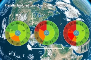
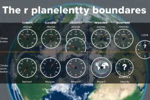
The planetary boundaries framework, first proposed in 2009 and updated in 2015 and 2023, identifies nine Earth-system processes that regulate the stability and resilience of the planet. As of the 2023 assessment, six of these nine boundaries are transgressed, meaning human activities have pushed them beyond the safe operating space. Crucially, the nature of transgression differs: some boundaries are global in scale, with a single planetary threshold, while others are defined by regional limits that, when aggregated, can destabilize the Earth system. The current status is that both global and regional boundaries are under severe pressure, with regional transgressions often occurring in multiple locations simultaneously, increasing the risk of large-scale tipping dynamics.
Control variable
The planetary boundaries framework does not have a single control variable; instead, each boundary is associated with one or more control variables that are measured at the appropriate spatial scale. For global boundaries, the control variable is a planetary-scale metric. For example, climate change is tracked by atmospheric CO2 concentration (ppm) and radiative forcing (W/m2), while ocean acidification uses global mean surface ocean aragonite saturation state. For regional boundaries, control variables are defined at sub-global scales, such as basin-level blue water consumption (freshwater use) or the percentage of original forest cover remaining within a biome (land-system change). The choice of control variable reflects the scale at which the Earth-system process operates and where the threshold is most meaningful.
Proposed boundary
The proposed safe boundary values are scale-dependent. For global boundaries, a single planetary threshold is set: climate change is bounded at 350 ppm CO2 and +1.0 W/m2 radiative forcing; ocean acidification at 80% of pre-industrial aragonite saturation. For regional boundaries, the framework defines a global aggregate limit but also specifies that the boundary must be respected at the regional scale. For instance, the freshwater change boundary (updated in 2023) sets a global limit on consumptive blue water use of 4,000 km3/year, but also requires that basin-scale freshwater consumption does not exceed 40% of mean monthly flow in any basin. Similarly, land-system change originally proposed that no more than 15% of global ice-free land be converted to cropland, but the 2015 update shifted focus to maintaining forest cover at biome-level thresholds (e.g., 85% of original forest cover in tropical biomes, 50% in temperate, 30% in boreal). Biogeochemical flows have both global boundaries (e.g., industrial nitrogen fixation limited to 62 Tg N/year) and regional phosphorus flow limits to avoid widespread eutrophication.
Current measured value
As of the 2023 assessment, the global boundaries for climate change (CO2 concentration at 417 ppm, radiative forcing at 2.91 W/m2), biosphere integrity (genetic diversity loss measured by extinction rate), and novel entities (based on plastic pollution and synthetic chemical release) are transgressed. For regional boundaries, freshwater change is transgressed at the global scale and in many basins; land-system change is transgressed in multiple biomes; and biogeochemical flows (nitrogen and phosphorus) are severely transgressed both globally and regionally. Stratospheric ozone depletion remains within the safe zone globally, though regional Antarctic ozone holes still occur. Atmospheric aerosol loading is not yet quantified globally, but regional transgressions are observed in South Asia. Ocean acidification is approaching the boundary but currently within the safe zone.
How the boundary is calculated
The calculation of boundaries depends on the scale. Global boundaries are derived from Earth-system models that identify critical thresholds at which feedbacks could destabilize the Holocene-like state. For example, climate models and paleoclimate data suggest that CO2 concentrations above 350 ppm and radiative forcing beyond 1 W/m2 risk triggering ice-sheet loss and other tipping points. Regional boundaries are calculated using spatially explicit models and observations. Freshwater use boundaries are based on basin-scale hydrological models that estimate environmental flow requirements. Land-system change boundaries rely on biome-specific forest cover thresholds that maintain ecosystem functions. Biogeochemical flow boundaries are derived from global nutrient cycle models and regional water quality data. The 2023 update introduced a more systematic approach to defining regional boundaries by identifying sub-global tipping points and aggregating them to a global safe limit.
Historical trend
The understanding of spatial scales in the planetary boundaries framework has evolved. The original 2009 paper proposed all boundaries as global, but acknowledged that some processes operate at regional scales. The 2015 update explicitly distinguished between global and regional boundaries, introducing a two-tier approach: a global boundary and a regional distribution of impacts. For example, freshwater use was reframed as a global boundary on consumptive use, with sub-global boundaries to prevent basin-scale collapse. The 2023 update further refined regional boundaries, particularly for freshwater, land-system change, and biogeochemical flows, incorporating more granular data and recognizing that regional transgressions can interact to produce global effects. Historically, human pressures on regional boundaries have increased dramatically since the Industrial Revolution, with acceleration after 1950. Many regional boundaries were likely transgressed in the 20th century, but precise dating is difficult due to data limitations.
What is driving the change
The primary drivers of boundary transgression are human activities, though the specific drivers vary by scale. Global boundaries are driven by aggregate global emissions and resource extraction: fossil fuel combustion and deforestation drive climate change and ocean acidification; industrial agriculture and fossil fuel use drive biogeochemical flows. Regional boundaries are driven by localized land-use change, water extraction, and pollution. Agricultural expansion is the main driver of land-system change and freshwater use, while urbanization and industrial activities contribute to regional aerosol loading and novel entities. The drivers are interconnected: global demand for food and commodities drives regional land conversion and water use, linking global economic systems to regional environmental pressures.
What crossing the boundary means
Crossing a global boundary risks triggering irreversible, planetary-scale tipping points, such as the collapse of the Atlantic Meridional Overturning Circulation or the loss of the Greenland ice sheet. Crossing a regional boundary can lead to local or regional tipping points, such as the dieback of the Amazon rainforest, the collapse of freshwater ecosystems, or persistent eutrophication of lakes and coastal zones. However, regional transgressions are not isolated: when multiple regional boundaries are crossed simultaneously, the cumulative effect can destabilize the Earth system as a whole. For example, widespread deforestation across tropical biomes can alter global rainfall patterns and accelerate climate change. Thus, respecting regional boundaries is essential to maintaining the resilience of the global system.
Regional variations
Several planetary boundaries are explicitly regional in nature, meaning their safe limits must be defined and respected at sub-global scales. The key regional boundaries are:
- Freshwater change: The boundary is defined by basin-scale blue water consumption and, in the 2023 update, also by green water (soil moisture) deviations. Transgression occurs when water withdrawals exceed environmental flow requirements in a river basin. Currently, many major basins, including the Colorado, Indus, and Yellow River, are severely transgressed.
- Land-system change: The boundary focuses on the amount of natural ecosystem area remaining within each biome. The 2015 framework set biome-specific forest cover thresholds: 85% for tropical, 50% for temperate, and 30% for boreal forests. Large-scale deforestation in the Amazon, Southeast Asia, and Central Africa has pushed several biomes into the high-risk zone.
- Biogeochemical flows: While the global nitrogen boundary is transgressed, regional phosphorus flows into freshwater systems cause widespread eutrophication. Regional boundaries for phosphorus are often defined by critical loads in lakes and coastal waters, and many regions exceed these loads.
- Biosphere integrity: Although genetic diversity loss is a global metric, functional diversity loss is often assessed regionally. The biodiversity intactness index varies widely, with some regions losing over 50% of original species abundance.
- Atmospheric aerosol loading: This boundary is not yet quantified globally, but regional aerosol loading, particularly in South Asia, is known to disrupt monsoon patterns and cause significant health impacts.
Interaction with other boundaries
Regional and global boundaries are tightly coupled. Transgression of regional land-system change can amplify climate change through carbon release and albedo changes. Regional freshwater overuse can reduce terrestrial carbon sinks, exacerbating climate change. Biogeochemical flows from agricultural regions contribute to ocean dead zones, linking to biosphere integrity loss. Conversely, global climate change can worsen regional water scarcity and accelerate biodiversity loss. The framework emphasizes that respecting regional boundaries is a prerequisite for staying within global boundaries, as regional tipping points can cascade into global tipping dynamics.
Impacts on people and ecosystems
Transgressing regional boundaries directly affects human well-being and ecosystem services. Freshwater overuse leads to water scarcity, crop failure, and conflict. Land-system change reduces biodiversity, disrupts pollination, and increases flood risks. Regional eutrophication causes fish kills, toxic algal blooms, and loss of recreational waters. Aerosol loading contributes to respiratory diseases and alters rainfall, affecting agriculture. These regional impacts often disproportionately affect vulnerable communities, raising issues of environmental justice. Moreover, the loss of regional ecosystem services can undermine local economies and drive migration.
Possible pathways back toward the safe zone
Returning to the safe operating space requires actions at both global and regional scales. For regional boundaries, governance at the landscape, basin, or national level is critical. Examples include:
- Implementing integrated water resource management and setting enforceable environmental flow standards.
- Promoting reforestation and sustainable land-use planning that respects biome-specific forest cover thresholds.
- Reducing nutrient pollution through precision agriculture, improved wastewater treatment, and circular economy approaches.
- Strengthening regional air quality regulations to limit aerosol emissions.
Global cooperation is also needed to address the drivers of regional pressures, such as international trade in agricultural commodities. Aligning global supply chains with regional boundaries can help reduce transgression.
Scientific uncertainty
Defining regional boundaries involves significant uncertainties. The precise threshold for ecosystem collapse varies with local conditions, and data on historical baselines are often sparse. For freshwater, environmental flow requirements are context-dependent and contested. For land-system change, the relationship between forest cover and ecosystem function is nonlinear and influenced by fragmentation. The interaction of multiple regional transgressions is poorly understood, making it difficult to predict when regional tipping points might cascade globally. Additionally, monitoring capacity is uneven, with many regions lacking adequate data. The 2023 update acknowledges these uncertainties and calls for precautionary approaches.
Criticism and alternative frameworks
The planetary boundaries framework has been criticized for its treatment of regional boundaries. Some researchers argue that aggregating regional limits into a global boundary oversimplifies complex spatial dynamics and may obscure local priorities. Others contend that the framework does not adequately address social dimensions, such as equity and governance, which are essential for managing regional resources. Alternative concepts like the “doughnut economics” model integrate social boundaries with planetary boundaries, emphasizing that a safe and just space must be defined at both global and local scales. The “safe and just Earth system boundaries” approach, published in 2023, further refines regional boundaries by incorporating justice criteria, such as ensuring access to water and food. Despite criticisms, the planetary boundaries framework remains influential in highlighting the multi-scale nature of Earth-system governance.
FAQ
Which planetary boundaries are global?
Climate change, ocean acidification, and stratospheric ozone depletion are inherently global boundaries because the control variables are well-mixed throughout the atmosphere or ocean. Atmospheric aerosol loading is also considered global, though its impacts are regionally heterogeneous.
Which planetary boundaries are regional?
Freshwater change, land-system change, biogeochemical flows (nitrogen and phosphorus), and biosphere integrity have strong regional dimensions. Their safe limits are defined at sub-global scales, such as river basins or biomes, and transgressions occur regionally before aggregating to global effects.
Why are some boundaries regional while others are global?
The spatial scale of a boundary reflects the underlying Earth-system process. Processes like greenhouse gas concentrations mix globally, so a single global threshold applies. In contrast, water use, land conversion, and nutrient pollution are inherently local to regional activities, and their impacts are felt first at those scales, though they can cascade globally.
What happens if a regional boundary is transgressed?
Transgression of a regional boundary can cause local ecosystem collapse, such as river basin closure, deforestation tipping points, or lake eutrophication. If multiple regional boundaries are crossed simultaneously, the cumulative effect can destabilize larger Earth-system functions, potentially triggering global tipping points.
References
- Rockström, J., et al. (2009). A safe operating space for humanity. Nature, 461, 472–475.
- Steffen, W., et al. (2015). Planetary boundaries: Guiding human development on a changing planet. Science, 347(6223), 1259855.
- Richardson, K., et al. (2023). Earth beyond six of nine planetary boundaries. Science Advances, 9(37), eadh2458.
- Gleeson, T., et al. (2020). The water planetary boundary: interrogation and revision. One Earth, 2(3), 223–234.
- Lade, S. J., et al. (2020). Human impacts on planetary boundaries amplified by Earth system interactions. Nature Sustainability, 3, 119–128.