In brief
At a glance
Quick Facts
- Global soil erosion rates
- Estimated to be 10–40 times higher than soil formation rates.
- Dominant erosion type
- Water erosion affects over 1 billion hectares worldwide.
- Widely used prediction model
- The Universal Soil Loss Equation (USLE) and its revised version (RUSLE).
- Conservation agriculture impact
- Can reduce erosion by up to 90% compared to conventional tillage.
- Sediment as pollutant
- Sediment is the largest water pollutant by volume globally.
- Wind erosion transport
- Wind can carry soil particles thousands of kilometers.
- Annual cropland loss
- Soil erosion contributes to the loss of about 10 million hectares of cropland each year.
Key Takeaways
- Soil erosion is the detachment and movement of soil particles by water, wind, or tillage, often accelerated by human activities.
- Measurement methods range from field-based techniques like erosion plots and pins to remote sensing and predictive models.
- The main drivers include rainfall intensity, slope, soil type, vegetation cover, and land management practices.
- Effective erosion control is vital for maintaining soil fertility, water quality, and long-term food security.
What Is Soil Erosion and How Is It Measured?
Soil erosion is the process by which soil particles are detached from the land surface and transported by natural forces such as water and wind, or by mechanical disturbance like tillage. It is a natural geological phenomenon that shapes landscapes over millennia, but human activities have accelerated it to rates far exceeding natural soil formation. Measurement of soil erosion involves quantifying the amount of soil lost from a given area over a specific time period, as well as understanding the processes and factors that drive it. This is done through a combination of field observations, experimental plots, sediment sampling, erosion pins, surveying, and modeling approaches that estimate soil loss under various conditions.
Accurate measurement is essential for land management and conservation planning. Field methods provide direct, site-specific data, while models allow extrapolation to larger areas and future scenarios. The choice of method depends on the scale of interest, available resources, and the type of erosion being studied. Together, these approaches help scientists and land managers assess erosion severity, identify vulnerable areas, and evaluate the effectiveness of control practices.
Overview
Soil erosion is a major environmental challenge that affects all continents. It reduces the productivity of agricultural land, degrades water quality, and contributes to the siltation of reservoirs and waterways. The global extent of human-induced soil degradation is estimated to be nearly 2 billion hectares, with water erosion accounting for about 56% and wind erosion for about 28% of the affected area. While erosion is a natural process, its current rates are unsustainable in many regions, leading to a net loss of fertile topsoil that can take centuries to regenerate.

Measuring erosion is critical for developing effective soil conservation strategies and for assessing the sustainability of land use practices. Measurement techniques vary in scale from small plot studies to watershed and regional assessments, each with its own strengths and limitations. Advances in remote sensing, geographic information systems (GIS), and modeling have improved our ability to monitor and predict erosion over large areas, complementing traditional field-based methods.
How It Works
The erosion process begins with detachment, where soil particles are loosened from the soil mass. In water erosion, raindrop impact is a primary detaching force, dislodging particles and breaking down soil aggregates. Surface runoff then transports these particles downslope. The amount of soil moved depends on the erosivity of the rainfall and runoff, the erodibility of the soil, the slope length and steepness, and the presence of protective cover. Wind erosion similarly involves detachment by wind shear, transport by saltation, suspension, or surface creep, and deposition when wind speed decreases. Tillage erosion is the gradual downslope movement of soil caused by plowing and other mechanical operations, which can be significant on sloping land.
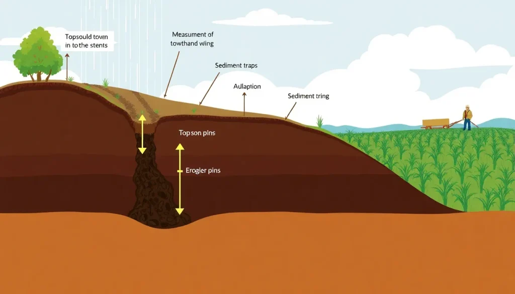
To measure erosion, scientists use a variety of techniques. Erosion plots are bounded areas where runoff and sediment are collected and measured after rainfall events. Erosion pins are metal rods inserted vertically into the soil; changes in the exposed length indicate soil loss or gain. Sediment traps and flumes capture transported material in streams, while surveying methods track changes in land surface elevation over time. At larger scales, models like the Universal Soil Loss Equation (USLE) and its revised version (RUSLE) estimate erosion based on factors such as rainfall erosivity, soil erodibility, slope length and steepness, cover management, and support practices. Remote sensing and GIS help map erosion-prone areas and monitor changes in land cover and topography.
Main Causes or Drivers
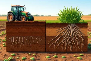
The primary drivers of soil erosion are climate, topography, soil properties, vegetation cover, and land management. Intense rainfall events and strong winds provide the energy for erosion. Steep slopes and long slope lengths increase runoff velocity and erosive power. Soils with low organic matter, poor structure, or high silt content are more erodible. Vegetation cover protects the soil from raindrop impact and wind, and its roots help bind soil particles. Human activities such as deforestation, overgrazing, and inappropriate agricultural practices (e.g., plowing up and down slopes, monocropping) remove this protective cover and disturb the soil, greatly accelerating erosion rates.
Water erosion is the most widespread form, driven by rainfall and surface runoff. It includes sheet erosion (uniform removal of thin layers), rill erosion (small channels), and gully erosion (larger incised channels). Wind erosion is common in arid and semi-arid regions with sparse vegetation, where strong winds lift and transport fine soil particles. Tillage erosion results from the downslope movement of soil by plowing and other mechanical operations, often on sloping land. The interaction of these drivers determines the severity and type of erosion in a given location.
Environmental and Human Impacts
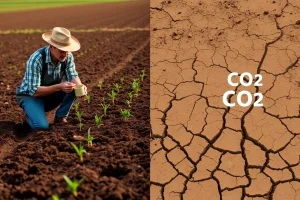
The consequences of soil erosion are far-reaching. On agricultural land, erosion removes the nutrient-rich topsoil, leading to declining crop yields and increased reliance on fertilizers. Off-site, sediment can fill stream channels, reservoirs, and drainage systems, increasing flood risk and reducing water storage capacity. Sediment also carries pollutants such as phosphorus, pesticides, and heavy metals, contributing to water pollution and eutrophication of lakes and coastal waters. In extreme cases, erosion can lead to land abandonment and desertification, threatening food security and livelihoods.
The economic costs include lost agricultural production, damage to infrastructure, and higher water treatment expenses. Erosion also affects biodiversity by degrading habitats and altering natural landscapes. Addressing soil erosion is therefore not only an environmental concern but also a socioeconomic imperative, particularly in regions where agriculture is the primary livelihood.
Solutions
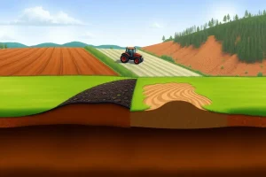
A range of practices can control soil erosion. Conservation tillage leaves crop residues on the field to protect the soil surface. Cover crops planted during fallow periods provide continuous cover. Contour farming and strip cropping follow the land’s contours to slow runoff. Terracing and grassed waterways are structural measures for steeper terrain. Windbreaks and shelterbelts reduce wind speed. On a larger scale, land-use planning, reforestation, and policies that promote sustainable land management are critical. The choice of measures depends on local conditions, and integrated approaches that combine multiple practices are often most effective.
Effective erosion control requires a combination of agronomic, vegetative, and structural measures tailored to the specific erosion processes and landscape. Education and extension services help farmers adopt these practices, while incentives and regulations can encourage widespread implementation. Long-term monitoring is essential to verify the effectiveness of interventions and adapt strategies as conditions change.
Data Limitations and Uncertainties
Measuring soil erosion accurately is challenging due to spatial and temporal variability. Direct field measurements are often limited to small areas and short time periods, making it difficult to capture rare, high-magnitude events that cause most erosion. Erosion models, while useful, rely on input data that may be uncertain or unavailable, such as detailed rainfall intensity records or soil erodibility factors. Remote sensing can detect large-scale erosion features but may miss subtle sheet erosion. Additionally, there is often a lack of long-term monitoring data, particularly in developing countries, which hinders trend analysis and model validation.
These uncertainties underscore the need for improved monitoring networks, data sharing, and the development of more robust models that can operate with limited data. Advances in technology, such as high-resolution satellite imagery and machine learning, offer new opportunities to reduce these limitations, but ground-truthing remains essential to ensure accuracy.
FAQ
What is soil erosion?
Soil erosion is the process by which soil particles are detached and moved by water, wind, or tillage, leading to the loss of topsoil.
How is soil erosion measured?
It is measured using field methods like erosion plots and pins, sediment sampling, remote sensing, and predictive models such as the Universal Soil Loss Equation (USLE).
Why does soil erosion matter?
It reduces soil fertility, lowers crop yields, degrades water quality, damages infrastructure, and can lead to desertification, threatening food security and ecosystems.
References
- Food and Agriculture Organization of the United Nations (FAO). 'Soil Erosion: The Greatest Challenge for Sustainable Soil Management.'
- United States Department of Agriculture (USDA) Natural Resources Conservation Service. 'National Soil Erosion Research.'
- Wischmeier, W.H., and D.D. Smith. 'Predicting Rainfall Erosion Losses: A Guide to Conservation Planning.' Agriculture Handbook No. 537.